CAD Blocks categories
 3D models
 home furniture
 sanitary ware - bathrooms
 professional equipment
 doors and windows
 people and animals
 plants and trees
 vehicles - transports
 architectural details
 mechanical - electrical
 urban planning - civil works
 safety health construction
 accessible design
 drawing sheet
 signals
 construction machinery
 accessories and objects
 maps and street maps
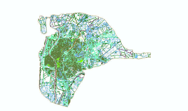
Detailed Sevilla Street Map in CAD

size: 3.079 kb
category: country maps
description: The image above shows a highly detailed CAD street map of Sevilla, ideal for use in urban planning and architectural designs.
file extension: .dwg CAD - AutoCAD software
Optimized Street Maps for Urban Planning
Comprehensive Overview of the Sevilla Map
This CAD file represents a detailed street map of Sevilla, capturing its intricate layout and urban planning features. Known by terms such as city layout CAD file or urban grid drawing, this file is highly useful for professionals in urban development and architectural design.
Dimensions and Resizing Instructions
To resize these dimensions, use the scaling tool by entering the desired conversion factor. For example, converting inches to meters involves multiplying by 0.0254. Refer to the Autodesk help page for the SCALE command for detailed instructions.
Usage in Urban Planning and Design
This CAD map of Sevilla is a vital resource for urban planners and architects, providing a precise representation of the city's streets and zoning. Such detailed CAD files enable seamless integration into project drafts and technical documentation.
Customizing the Sevilla Street Map
Modify the map to fit specific project needs by editing layers, adding annotations, or altering elements. Use the editing command to update dimensions, labels, and road networks. See the Autodesk help page for step-by-step guidance.
Interrelations with Other CAD Elements
This map connects seamlessly with other architectural CAD blocks, such as building outlines, transportation systems, and landscape designs, to form comprehensive urban models for advanced planning and engineering purposes.


